
Ben Nevis, the Venomous Mountain.
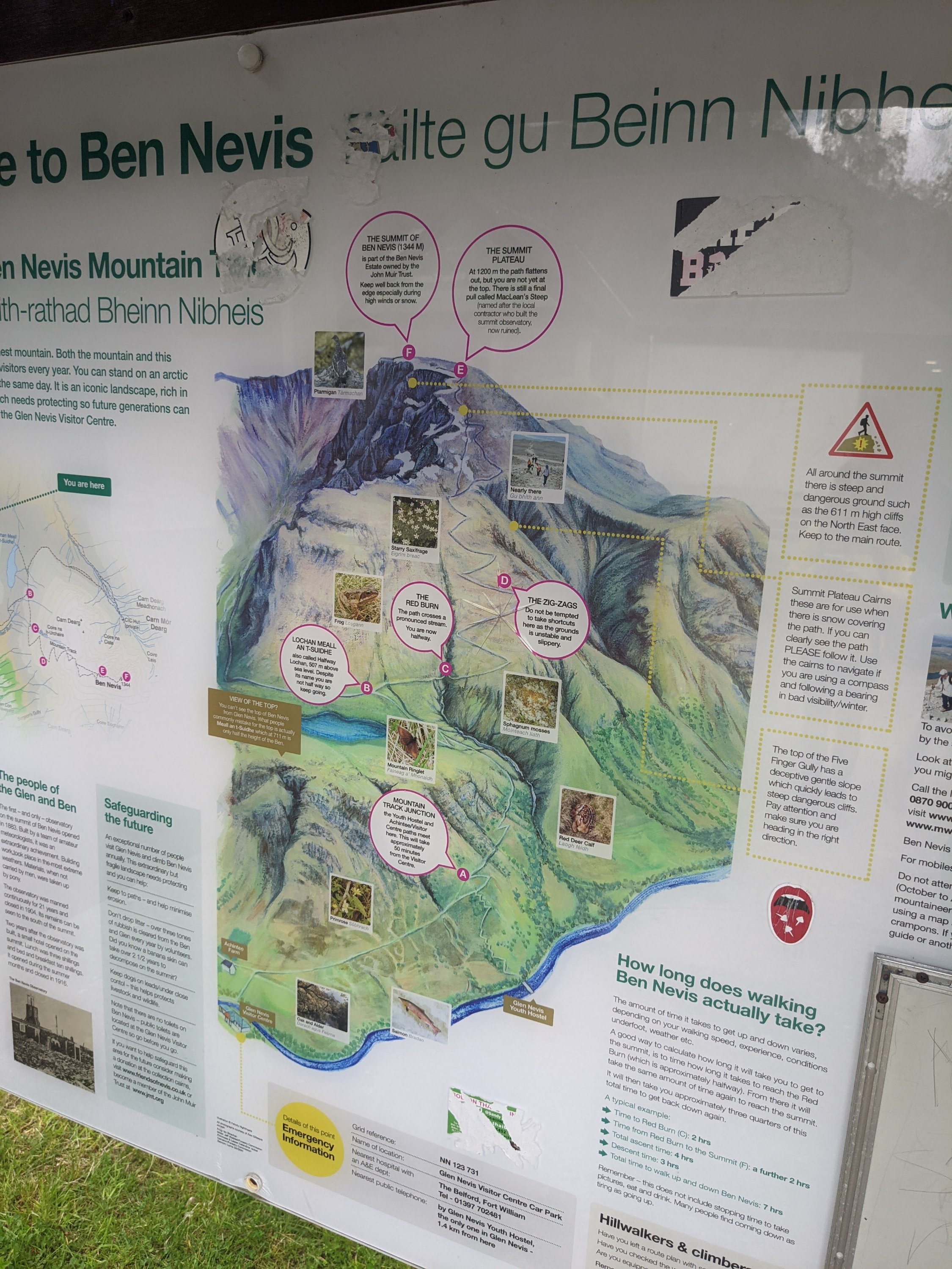
Ben Nevis, the summit of which is the highest point you can get to in the UK at 1345m, is surrounded by the stunning Scottish highland. This mountain is on many people’s bucketlist. In Scottish Gaelic many believe the name translates to The Venomous Mountain.

It’s definitely an achievable goal, just leave plenty of time to get up and down, most suggest 7-9 hours, take plenty of water and snacks and enjoy yourself! The walk up the tourist track is relatively easy, it’s only towards the summit where there are steep drops a couple of metres from the path, so if conditions and visibility are bad I’d recommendation turning back at this point.
Lucky for us the weather was pretty good when we left our Airbnb at half 7, we were staying in Corpach just a ten minute drive away. Find a parking spot at the Glen Nevis carpark, make sure your gear is comfy and your snack bag is full and off you go!

The first part of the climb is really pretty, crossing a river and heading up a small country path, note the Ben Nevis Inn on the left hand side…you’ll want to head there when you’ve made it back down.
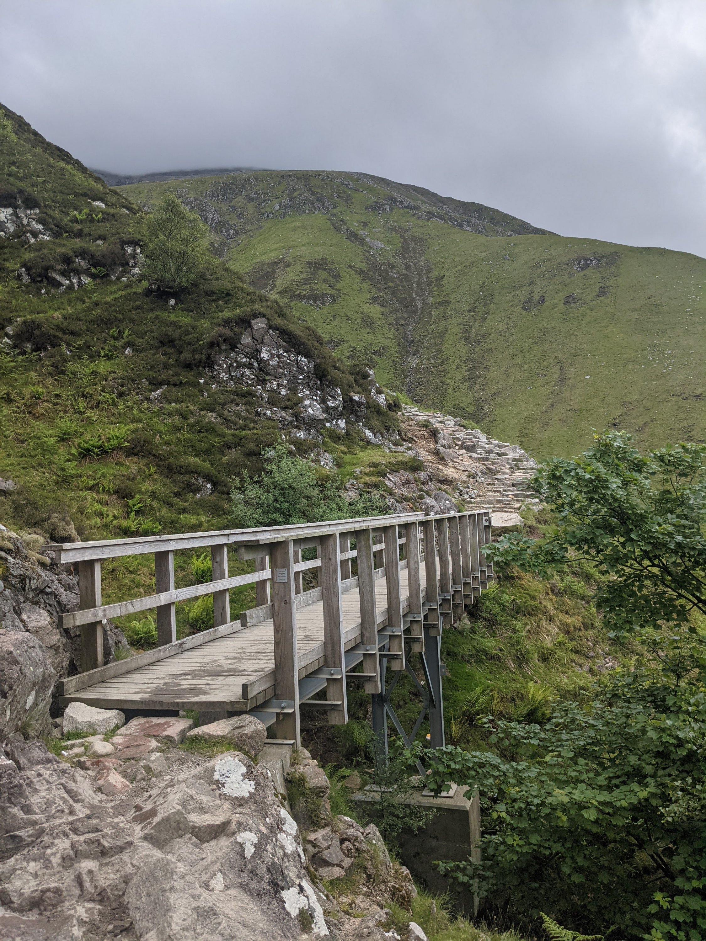

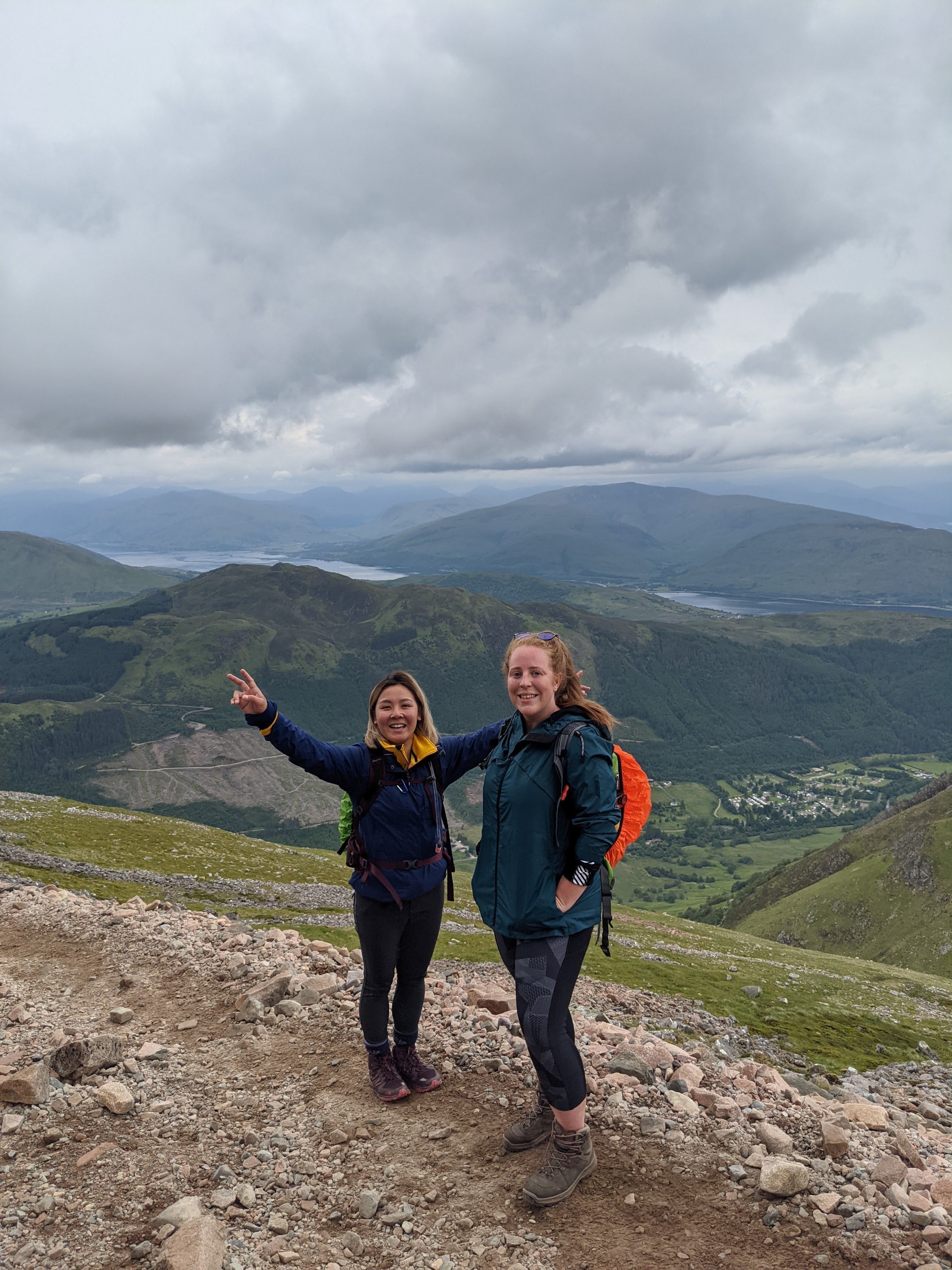
Now the real ascent starts, and once you’ve got some height you start to really appreciate the amazing views of the surrounding valley. This part of the route is well managed with only a few rocky outcrops to circumvent.
As you keep going up you’ll emerge onto the side of the ravine, and you can see the trail continuing far above you on the opposite side. We pushed ourselves to the top of this ravine to rest up at the unofficial halfway point, Lochan Meall an t-Siudhe.

We ventured off path and took a water and snack break, enjoying the views over the Loch and shovelling down homemade flapjack! After a short rest we were ready for the easiest part of the ascent.
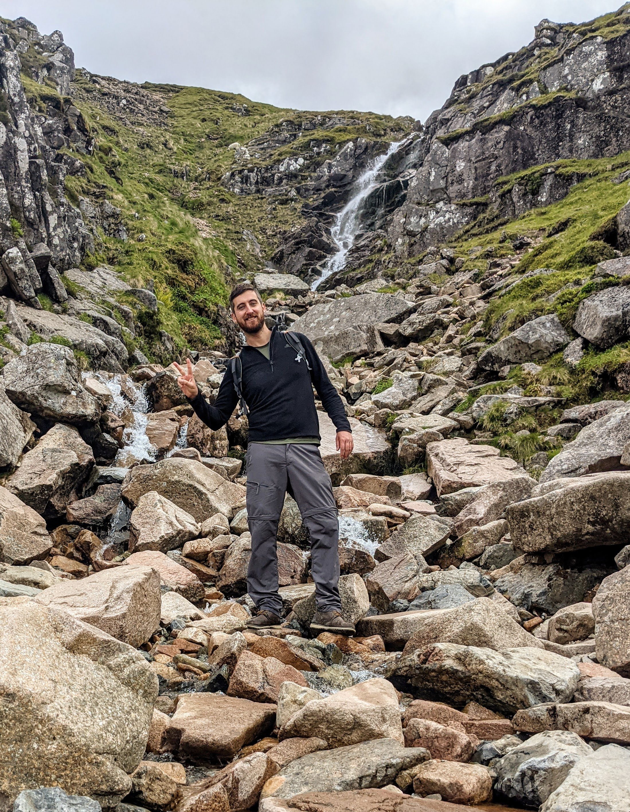
From the Loch we headed up and took the right hand path, this was the best part as it was just a gentle incline and nice flat path. You cross a gorgeous cascading waterfall along the way and realise you’ve gained real height when you realise you’re level with half the peaks you saw earlier.

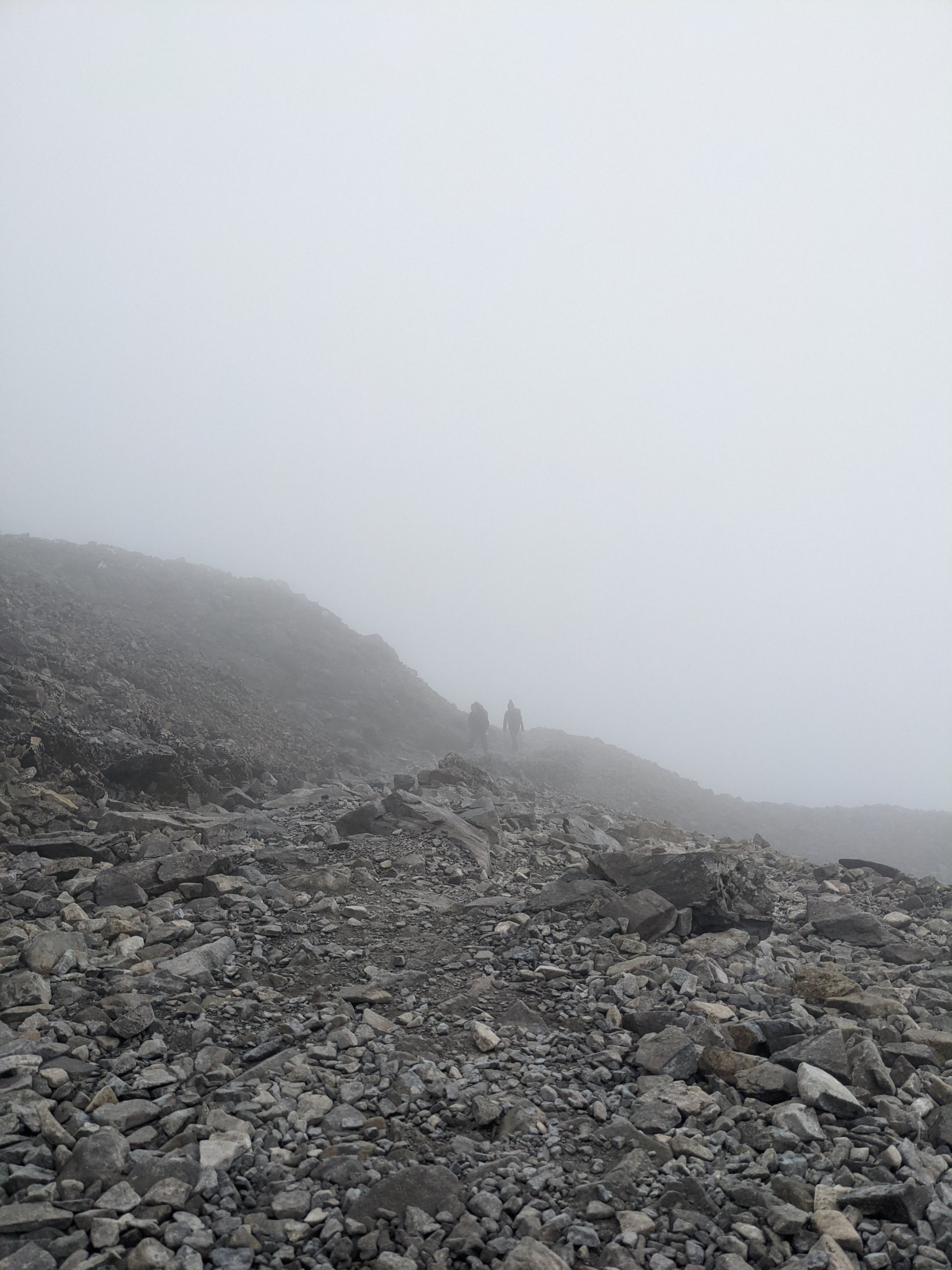
At the end of this trail is the part we found the hardest, the zig zag. Here the path zigzags up the steep side of Ben Nevis, with various sized rocks beneath your feet. You have to watch your step here to avoid twisted ankles. At this point the weather had turned slightly, so we were hiking in the clouds for much of it with poor visibility for the amazing views that we knew were around us.

This was a long slog but totally worth it as we got closer to the summit and started seeing snow still on the ground! There was even on spot where we had to hike up through the snow!
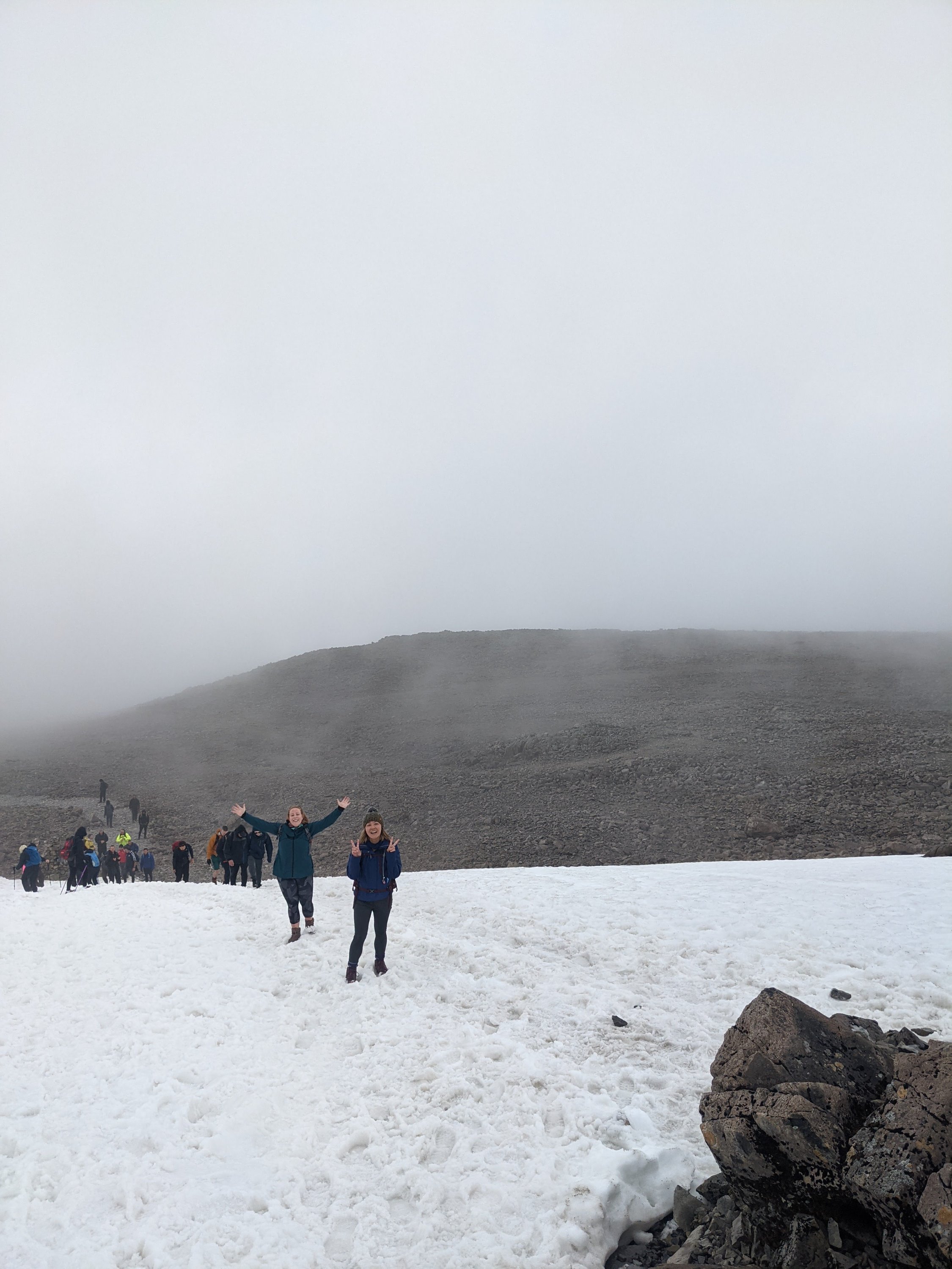
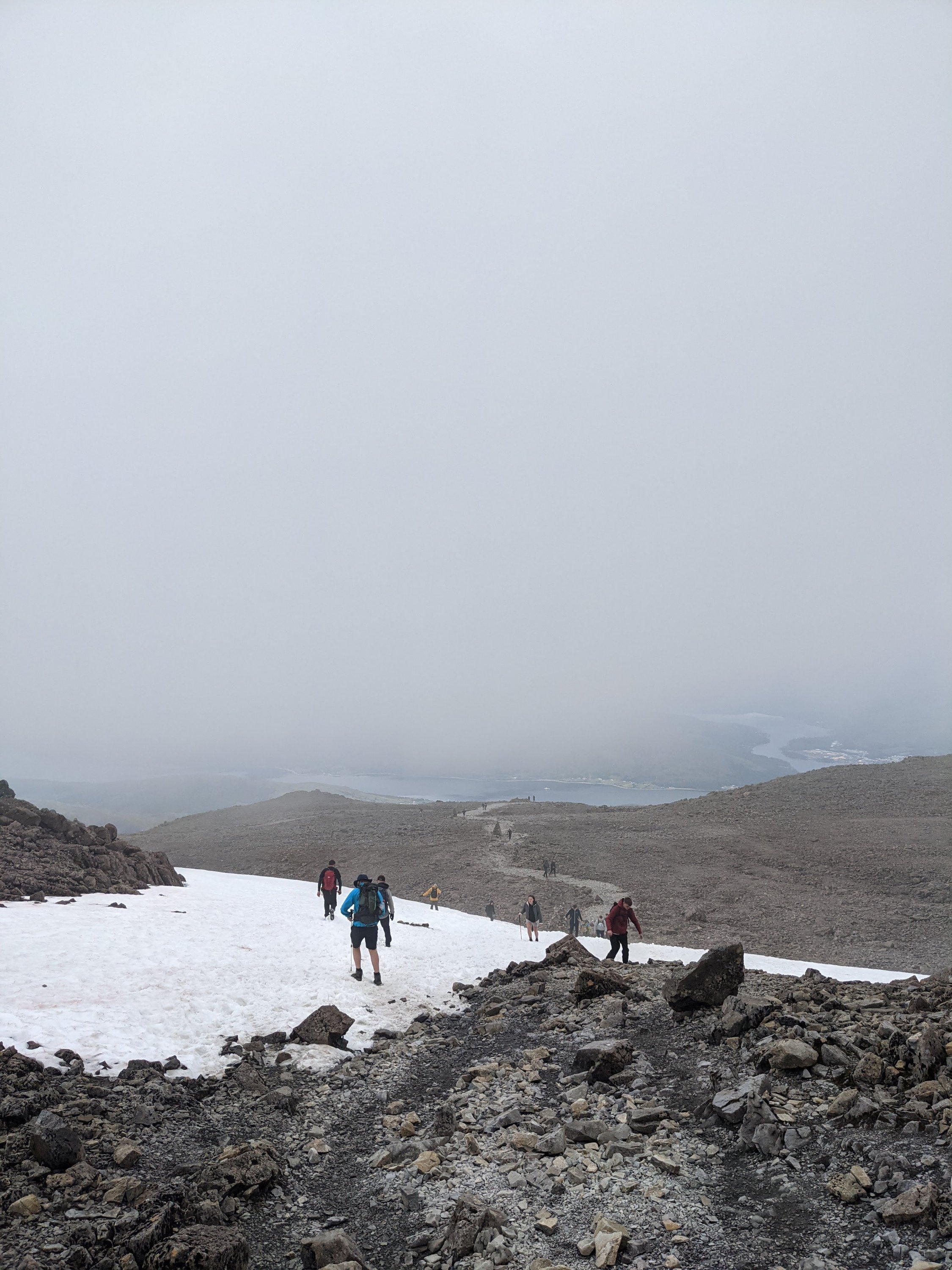
The cloud level was really low here but visibility wasn’t too bad and we could see a few metres ahead of us and the path was pretty obvious.
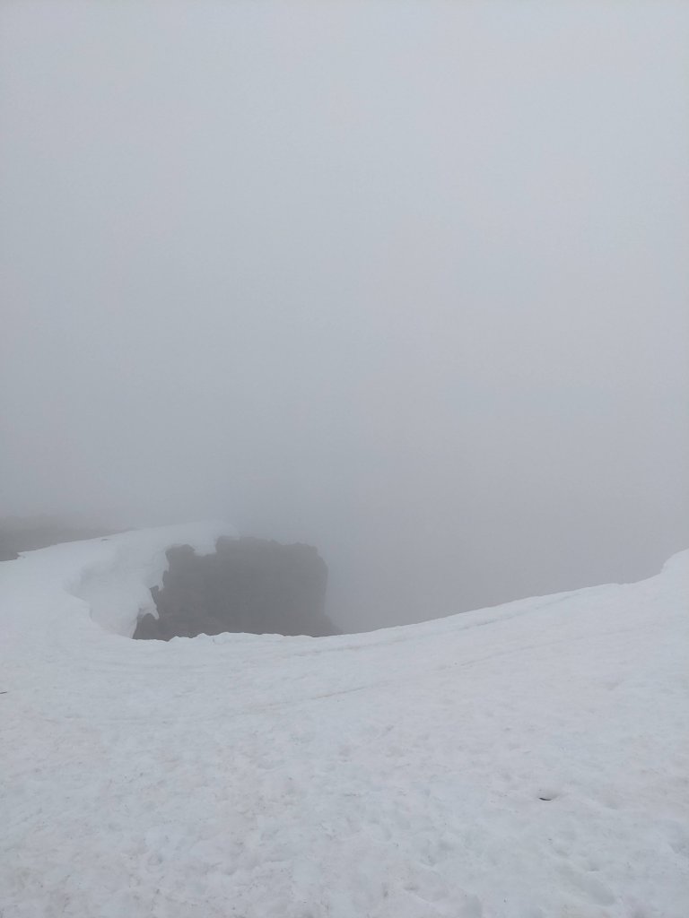
However we did go past these huge drops where there was snow and then nothing, and it’s easy to see how careful you would have to be in bad weather.
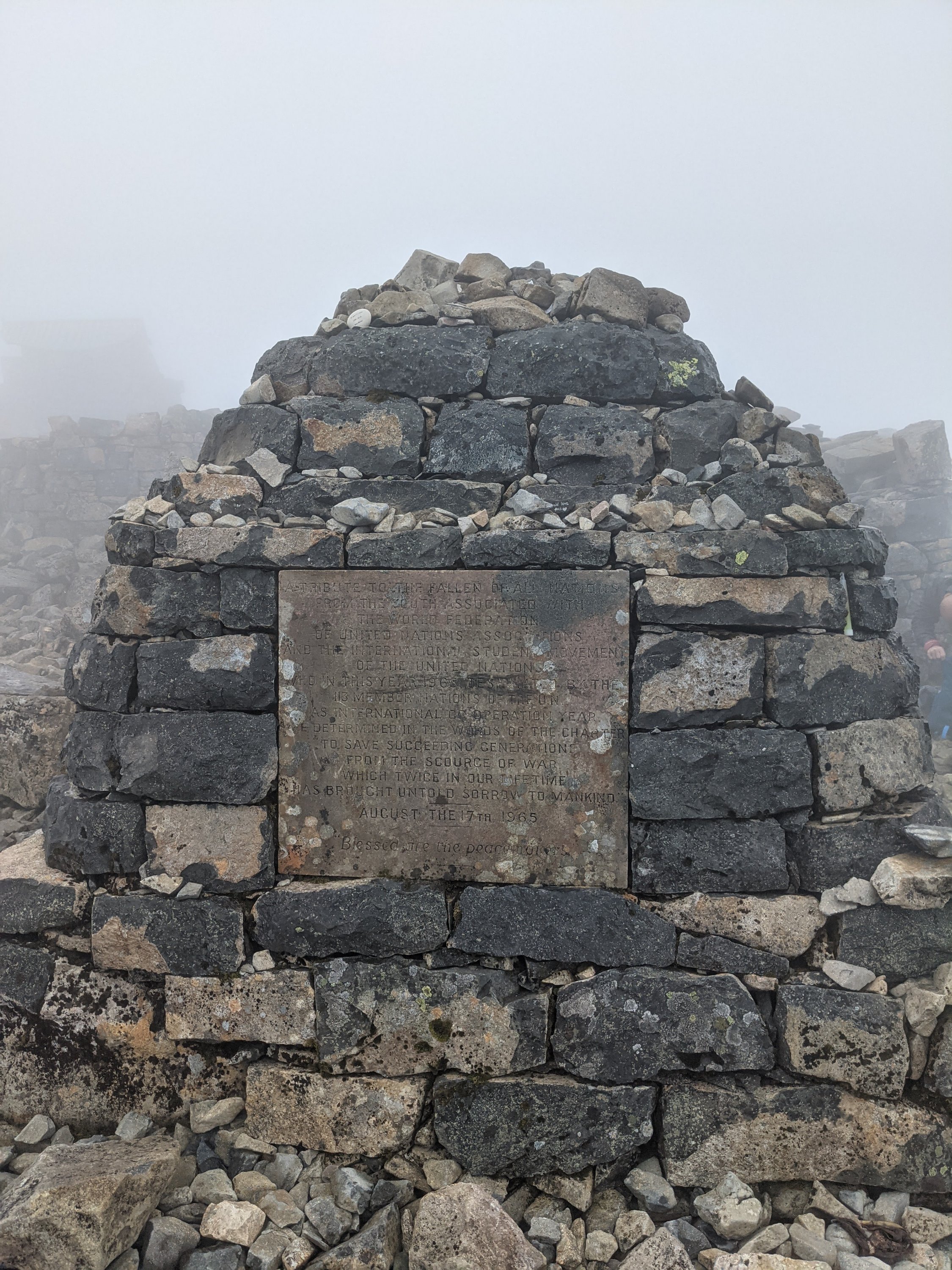
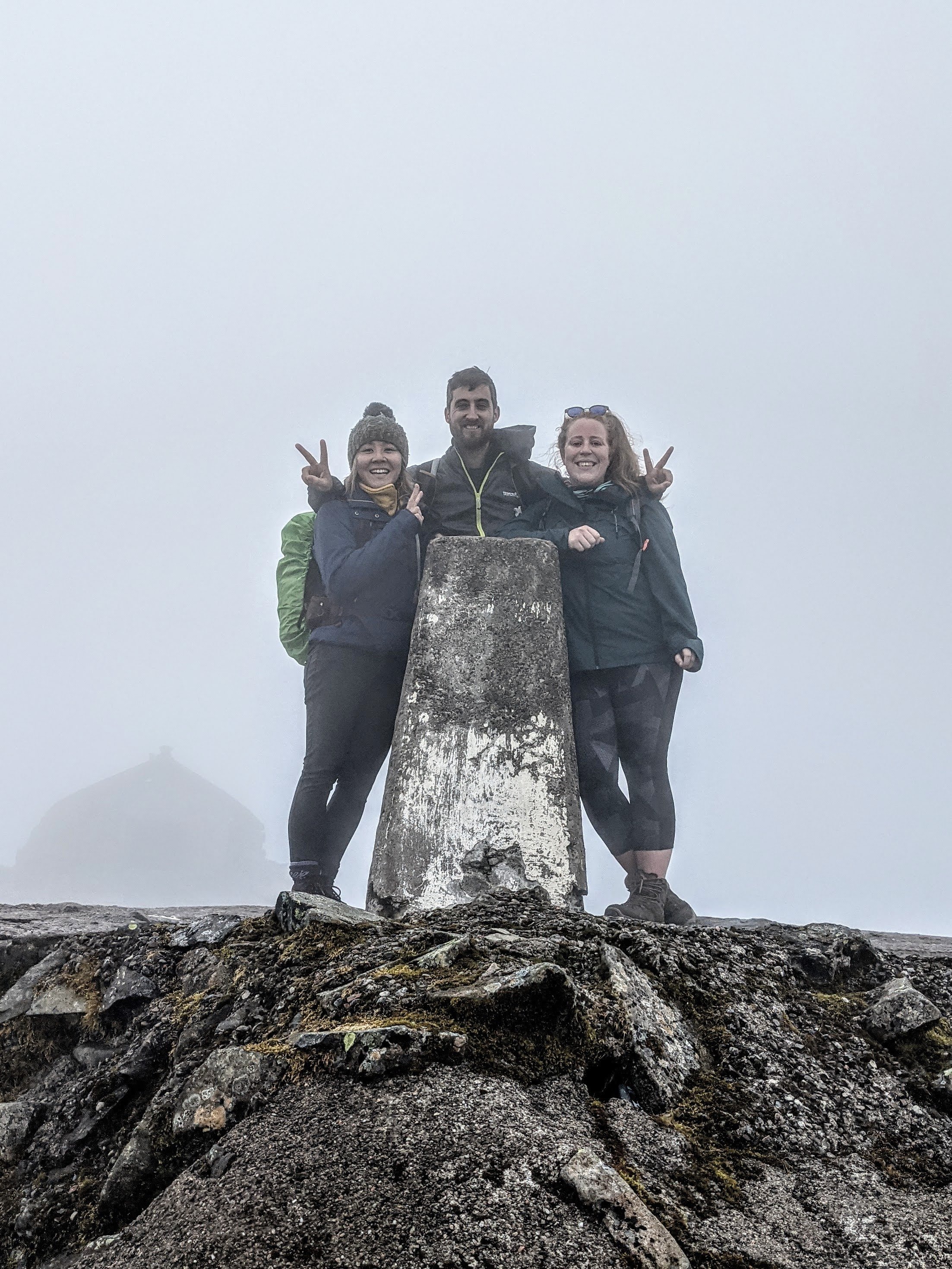
One last push took us up to the summit and we had done it! We took an obligatory Trig point pic and checked out the ruins and old observatory buildings. They used to use this as a weather station for many years.
After a sugar boost and rest it was time to hike back down. Please remember to take all your rubbish with you as unfortunately there was quite a bit left amongst the ruins.
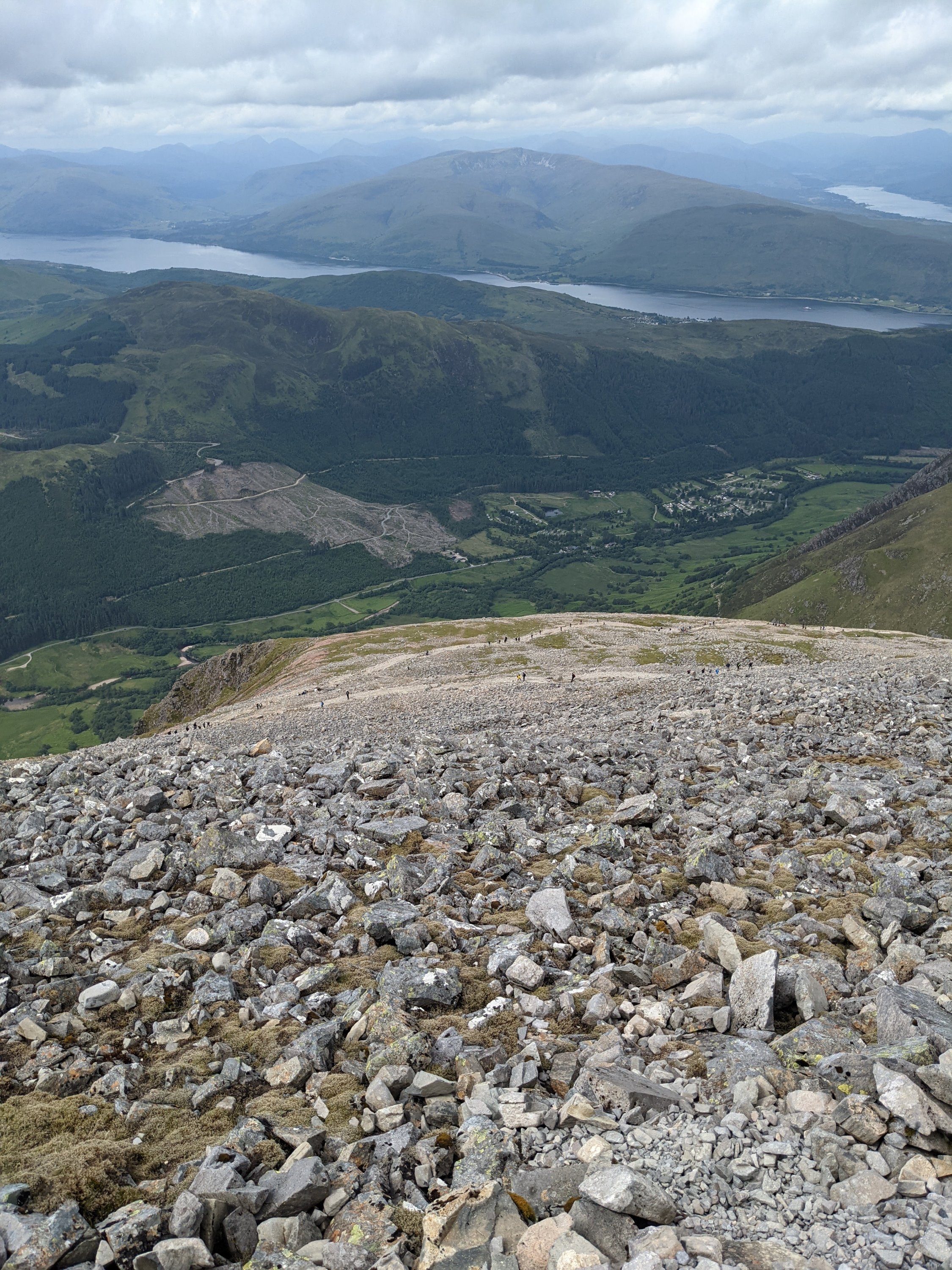
Lucky for us the clouds started to lift as we descended, affording us amazing views of the Western highlands! It was amazing as the sun burned off the clouds and suddenly we could see all the lochs and peaks! Truly it is a wonderful place and one of the most beautiful views I’ve seen.

We stopped at the waterfall and refilled our bottles before having lunch near the Loch. One final push took us back down to the Inn where a shandy went down a treat as we rested our sore muscles. It took me 5:30 and the girls 6 hours! So chuffed.


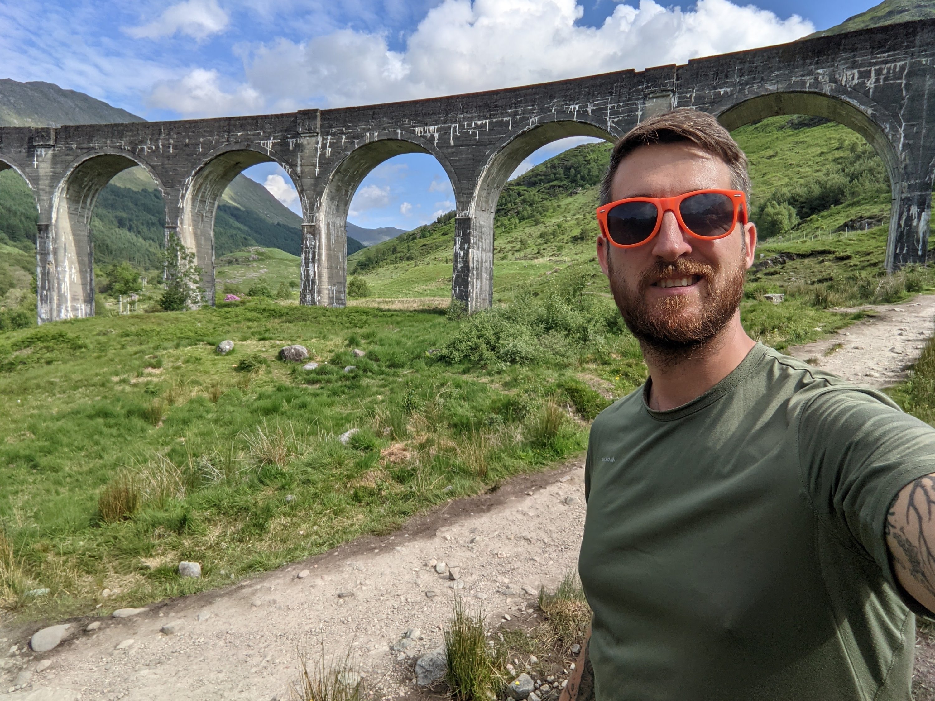
If you’re wondering what to do in the afternoon there are a few options around Fort William, we went to check out the Glenfinnan Viaduct which is 30 minutes drive away, famous for being featured in the Harry Potter films, it’s a beautiful structure crossing the valley.


Park up at the obvious stop and it was a cute walk along a Rhododendron studded river. Although we found out that the Rhododendron are invasive species and taking over!
You can see the viaduct from here and there are a few paths you can take to get the full view! If you’re lucky you’ll see the train puffing away across the track.

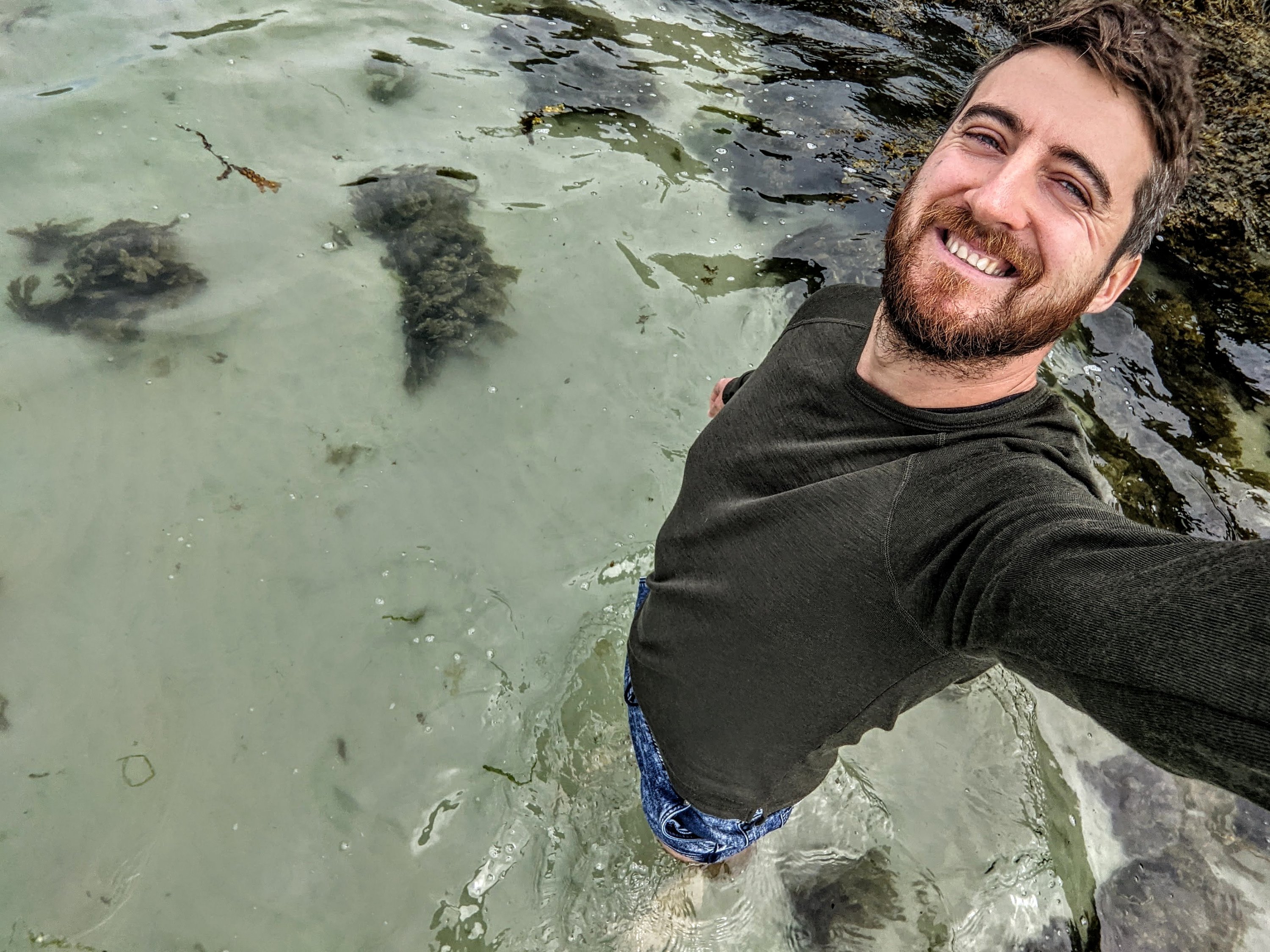
Another great thing to do is drive up to Morar beach and relax on the beautiful white sands! It’s about a 45 minute drive away and people were even wild camping there when we arrived. We even jumped in the cold water for a quick swim, so refreshing!


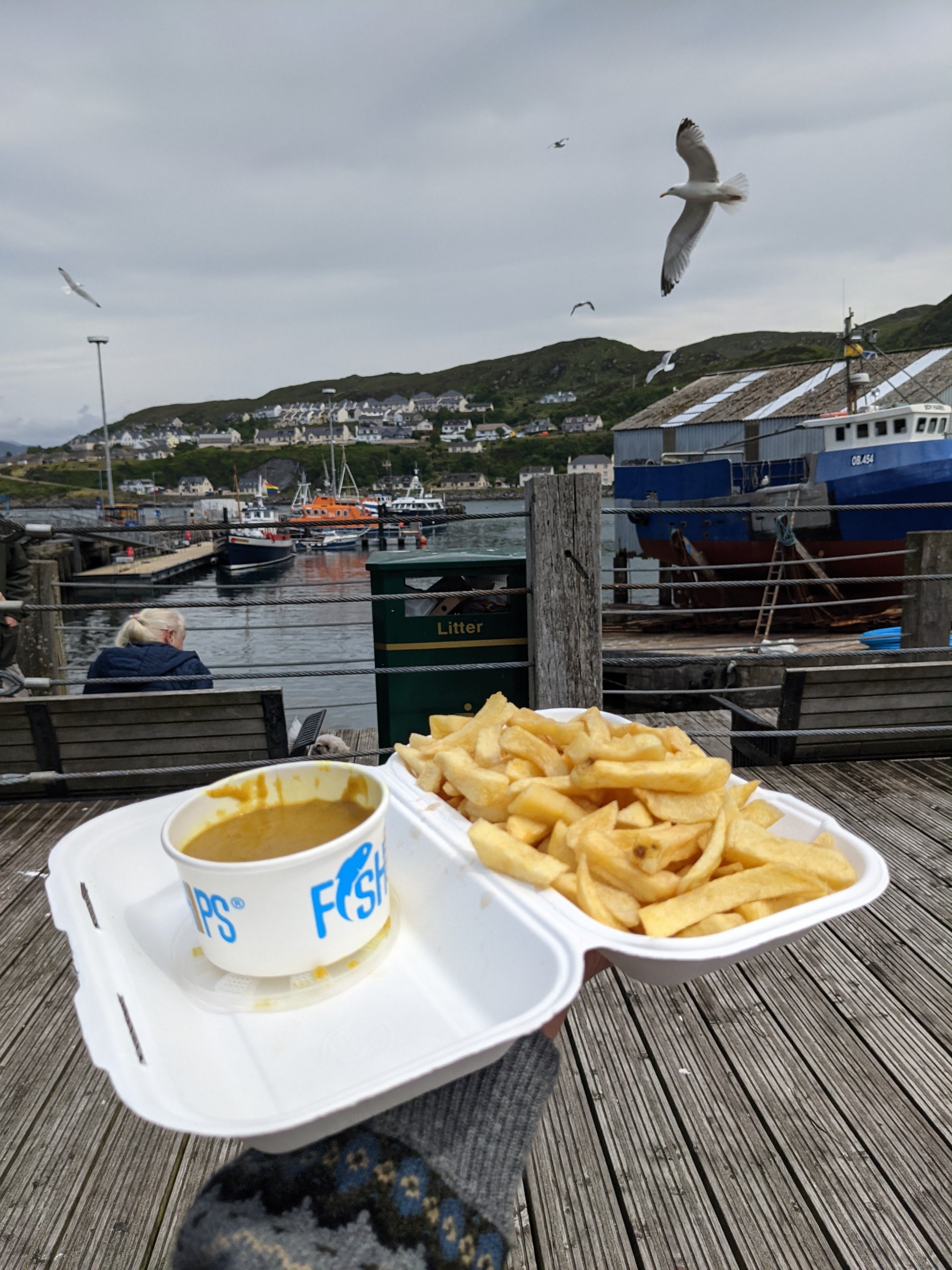
After that we nipped up to Mallaig for fish and chips which was amazing. We sat overlooking the docks, this is where you could head on to the Outer Hebrides islands such as Skye and Harris

The best thing we did though, was book an Airbnb with a hot tub! After such a big climb it was so nice to relax our muscles in the hot water, we even had views of Nevis from the tub!


The most important thing is to stay safe, keep hydrated, take lots of snacks and keep an eye on the weather as it can change so much! Hope you enjoy hiking the highest mountain in the UK as much as we did!
